Real-Time Trail Access: Tools, Apps, and Hacks That Work

Real-Time Trail Access: Tools, Apps, and Hacks That Work
Preperation is the key to success
Nothing ruins your trip faster than arriving at a closed trail. At campandoverland.com, our baseline is to avoid this – permanently. If this is important to you, DO NOT LEAVE THIS PAGE, in here we have every resource that you will need, with walkthoughs and links to figure out real-time trail access.
Heading into the Rockies? Don’t roll out blind.
Picture this—you’ve got your rig dialed in, gear strapped tight, and you’re chasing that perfect backcountry campsite. But three hours later, you hit a closed gate and a giant sign that reads: “Trail Closed – Flood Damage.” Brutal.
Whether you’re camping, hiking, or overlanding, knowing how to check real-time trail access can be the difference between a legendary trip and a wasted weekend. That’s why we put together this complete, no-fluff guide. We’ve dug through official sources, tested top-rated apps, and tapped into local off-road communities—so you don’t have to. This is your one-stop method to check trail conditions before camping or heading into remote areas.
Affiliate Disclosure: CampAndOverland participates in the Amazon Services LLC Associates Program, an affiliate advertising program designed to provide a means for sites to earn advertising fees by advertising and linking to Amazon.com.

Step-by-Step Guide to Real-Time Trail Access
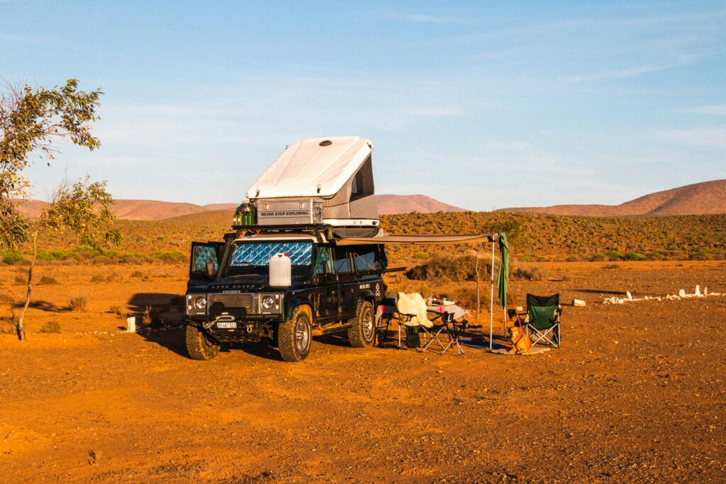
If you’re like most overlanders, your gear setup is on point. You’ve got traction boards, dual battery systems, rooftop tents—the works. But none of that matters if your trail is closed. This step-by-step checklist guarantees you check trail conditions before camping, so you’re not left rerouting on the fly or burning daylight with no signal.
Step 1: Start With Reliable Sources 📱
1. Official Park Websites and Resources
-
-
U.S. Forest Service: 🔗 fs.usda.gov – Find weekly alerts, trail closures, and seasonal updates.
-
National Park Service (NPS): 🔗 nps.gov – Use “Find a Park” to look up specific trail conditions by region.
-
Colorado Trail Explorer (COTREX): Ideal if you’re in the Rockies—real-time trail and road status across public lands.
-
2. Use Trail-Specific Applications. Read further down if you need help picking the right app.
-
onX Offroad: Hands-down the best for checking forest road access and seasonal vehicle route closures.
-
AllTrails: Great for trail reviews and alerts from other hikers (Pro version lets you set trail condition notifications).
-
Trailforks: Perfect for singletrack and backcountry users—check trail access and seasonal shut-offs.
-
Gaia GPS: Excellent for off-grid navigation—especially if you preload maps and overlays for offline use.
-
Avenza Maps: Load official PDFs (like BLM maps) and get geo-located data even when off the grid.
Use them in tandem for the best results: one for driving access, one for hiking conditions. Need help picking the right app? 👉 Check out our deep-dive here.
3. Local Social Media Groups (Facebook or Instagram). Keep going in this article to discover our top picks!
Bookmark them. Download them. Done.
Step 2: Confirm Conditions🌦️
Even if the trail looks open on a map, that doesn’t mean it’s passable. Before you go:
-
Check the trail status: Open or closed?
-
Scan for hazards: Flooding, snowpack, wildfires, downed trees, wildlife.
-
Look at the weather: Rain yesterday? That “open” trail might be mud soup today.
Don’t guess—double-check trail access across multiple platforms to confirm.
Step 3: Set Notifications and Alerts🔔
Here’s a game-changer: automate your trail status checks. Most apps and park services let you subscribe to email updates or push notifications. Set them up once, and let the alerts come to you.
This is especially helpful during shoulder seasons when access changes fast. AllTrails Pro and onX Offroad both allow you to set notification zones for saved routes.
Step 4: Always Have a Backup Plan🧭
Even the best plan can go sideways. That’s why smart overlanders always have a Plan B trail saved. Preferably two. Use your apps to pin nearby alternatives in case your primary route is blocked or turns into a slush pit.
When your weekend is on the line, backup options = peace of mind.
📍Up Next: We’ll cover real-world examples, how these tools saved trips, and how to spot bad info before it ruins your day.

Real-Time Trail Access: How These Tools Actually Save Trips
If you’ve ever tried to reach a remote trailhead after a storm, you know that apps and alerts aren’t just “nice to have”- they’re mission-critical. Real-time trail access isn’t just about checking a website. It’s about avoiding bad info, catching updates others miss, and adapting before your tires hit trouble.
Last summer, I was prepping for a long weekend in the San Juans. Rig loaded, fridge stocked, maps downloaded — everything was good to go. But just before leaving, I got a push alert from AllTrails Pro. Turns out, a lightning-sparked wildfire had closed three of the trails I had mapped out. If I hadn’t checked, I’d have driven five hours just to get turned around. Instead, I pivoted, found another open route and got the trip back on point.
Don’t Trust One Source—Cross-Check Like a Pro
Here’s what I’ve learned: even the best apps miss things sometimes. That’s why the pros always double-check. Be a pro. Using multiple trail status tools and tapping into community intel helps you catch stuff that might fall through the cracks.
Trail & Off-Road App Rankings: Best Apps to Check Trail Access
If you’re not using the right tools, you’re flying blind.
Trail closures, road gates, and surprise conditions can wreck a trip before it even starts. This list cuts through the noise and gives you exactly what works—the best apps for checking if a trail or access road is open. Whether you’re hiking in or wheeling deep into the backcountry, these are the tools that make sure you don’t waste your weekend.
Use this breakdown to find out which apps are worth downloading, which ones to upgrade, and how to use them together for the most accurate real-time trail access intel.
1. onX Offroad
-
Usefulness: Excellent for checking if forest roads, OHV routes, or public lands are open, with access dates, closures, and detailed land ownership info.
-
Best For: Overlanders, 4×4 rigs, SxS users, dirt bikes, and vehicle-based access.
-
Free vs. Paid: Free for basic maps; paid unlocks trail status layers, land boundaries, and offline use.
-
Verdict: Your best friend for road and access checks—if you drive dirt, this is non-negotiable.
2. AllTrails
-
Usefulness: Very strong for hiking trail closures, user-submitted conditions, and terrain hazards like snow or flood washouts.
-
Best For: Hikers, backpackers, casual campers.
-
Free vs. Paid: Free includes maps and reviews; Pro unlocks real-time alerts and offline use.
-
Verdict: Best paired with a vehicle-access tool like onX; the Pro version is worth it if you hike often.
3. Trailforks
-
Usefulness: Strong for seasonal trail closures, maintenance alerts, and MTB-access conditions with a huge user base.
-
Best For: Mountain bikers, singletrack hikers, and trail runners.
-
Free vs. Paid: Most maps are free; paid gives full global coverage and offline capabilities.
-
Verdict: A solid choice for singletrack scouting—less helpful for road access.
4. Gaia GPS
-
Usefulness: Great for visualizing routes, elevation, fire history, and overlays; lacks real-time trail status unless combined with other data.
-
Best For: Backcountry explorers, off-grid navigation, and long-distance route builders.
-
Free vs. Paid: Free for basic layers; paid adds weather, public land overlays, and MVUMs.
-
Verdict: A planning powerhouse—pair it with real-time apps for best results.
5. Colorado Trail Explorer (COTREX)
-
Usefulness: Excellent for live Colorado trail updates, state-managed alerts, and seasonal road closures in public lands.
-
Best For: Anyone hiking, biking, or off-roading in Colorado.
-
Free vs. Paid: Totally free; built by Colorado Parks and Wildlife.
-
Verdict: The best localized app for Coloradans—zero fluff, all function.
6. Avenza Maps
-
Usefulness: Great for viewing accurate PDF maps (like BLM or USFS) that show closures, but no live update functionality.
-
Best For: Offline use with official maps, especially in dead zones.
-
Free vs. Paid: Free for limited imports; premium for high-detail maps and pro features.
-
Verdict: A paper-map replacement—useful, but don’t rely on it alone for conditions.
Community Trail Intel: Real-Time Updates From People Who Were Just There
Apps and official websites are great—but sometimes, the best info comes from boots on the ground. Whether it’s a fresh post about a washed-out road, or someone dropping a video of a snow-covered switchback, local communities are your fastest source of trail intel.
That’s why we’ve curated this shortlist of Facebook and Instagram groups worth joining. They’re active, focused on the Rocky Mountain region, and loaded with first-person trail reports, closure alerts, and route advice from real users.
Social Media Off-Road Groups
| Group Name | Platform | Focus |
|---|---|---|
| Colorado Off Road Trail Reports | User-submitted CO trail reports | |
| Colorado 4×4 Club | Overlanding, rig builds, general trail use | |
| Colorado Offroad Crew | Wheeling, camping, local updates | |
| Rocky Mountain’s 4X4 | Adventure-based trail rides & tips | |
| Trailridge Runners 4×4 | Club-led Colorado trail runs | |
| Rocky Mountain Crawlers 4×4 Club | Multi-vehicle outdoor community | |
| Rock Junction & RM Off-Road Expo | Group rides + expo updates | |
| @rockynps | RMNP trail and weather alerts | |
| @i70things | I-70 traffic and mountain pass updates | |
| @coloradohikes | Trail updates, conditions, and inspiration | |
| @rockymountainrescuegroup | Search & Rescue alerts, safety conditions | |
| @the_jeep_community | Off-road trail photos and Jeep setups |
Final Thoughts
Overlanding isn’t just about the gear—it’s about the prep. You wouldn’t roll out with half your tools missing, and you shouldn’t hit the road without knowing if the trail is even open.
With the right apps, official resources, and community groups at your fingertips, checking real-time trail access becomes second nature. You’ll avoid wasted gas, dodged closures, and guarantee more weekends actually spent outdoors—not rerouting on the side of a dirt road.
So make it a habit:
-
Check official sources.
-
Use the right apps.
-
Cross-reference with the local community.
-
Have a backup plan.
Your future self (and your weekend crew) will thank you. Would you like to see more? Check out our Adventure Guide here.